Spatial Analysis
Spatial Analysis is a highly useful tool for gaining a deeper understanding of specific locations. The results of Spatial Analysis can provide valuable insights in the planning and decision-making processes. By utilizing the Spatial Analysis services we offer, you can optimize business strategies, reduce risks, and enhance operational efficiency with a strong and accurate data foundation.
How to use the service?
Click this button.
Spatial Analysis Solution Suite


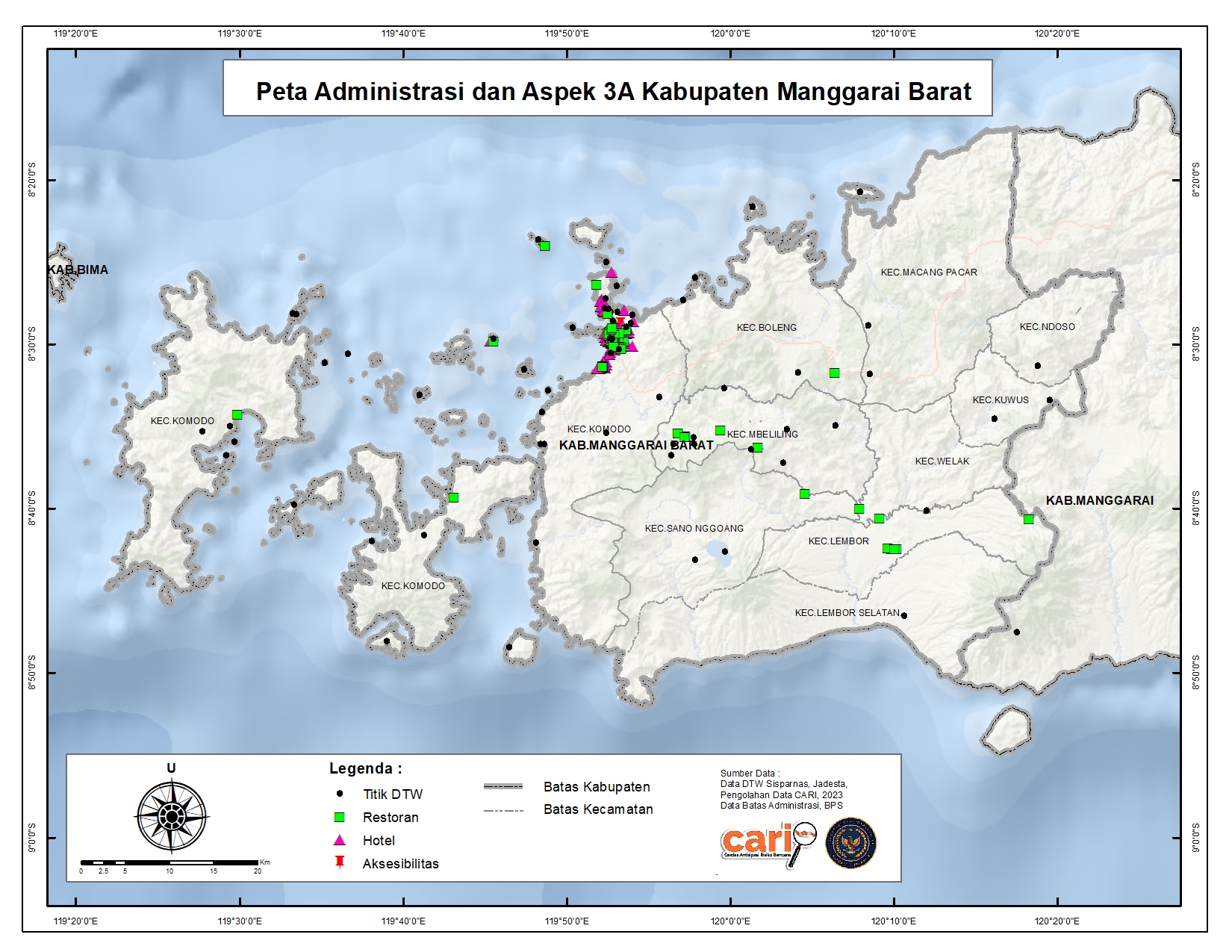
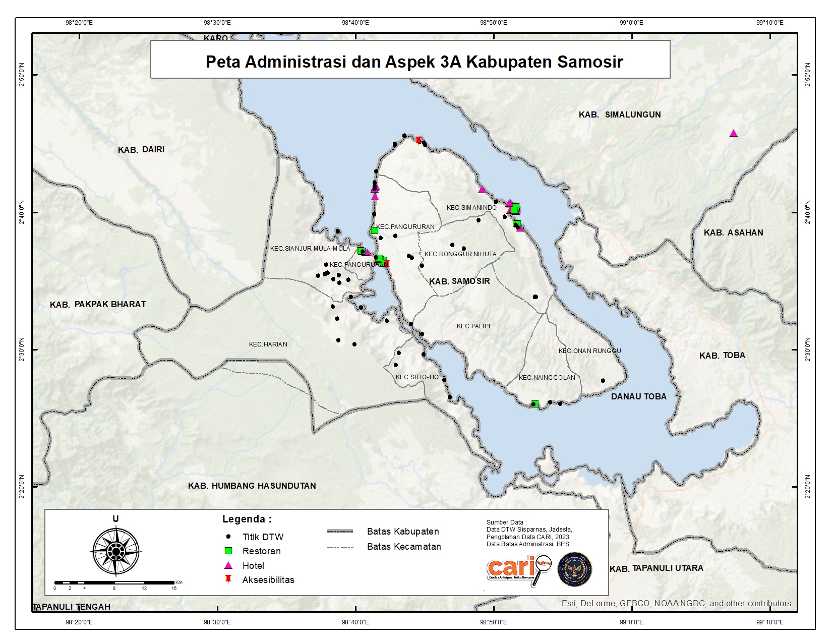
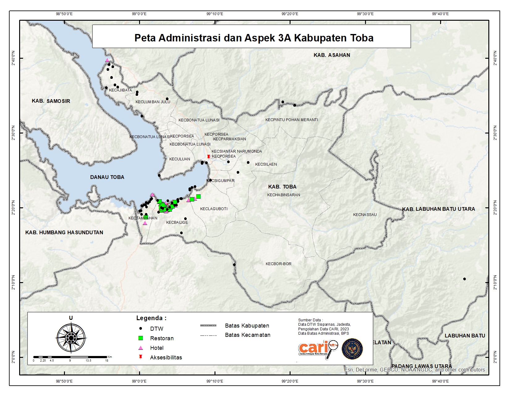
Spatial Data Visualization
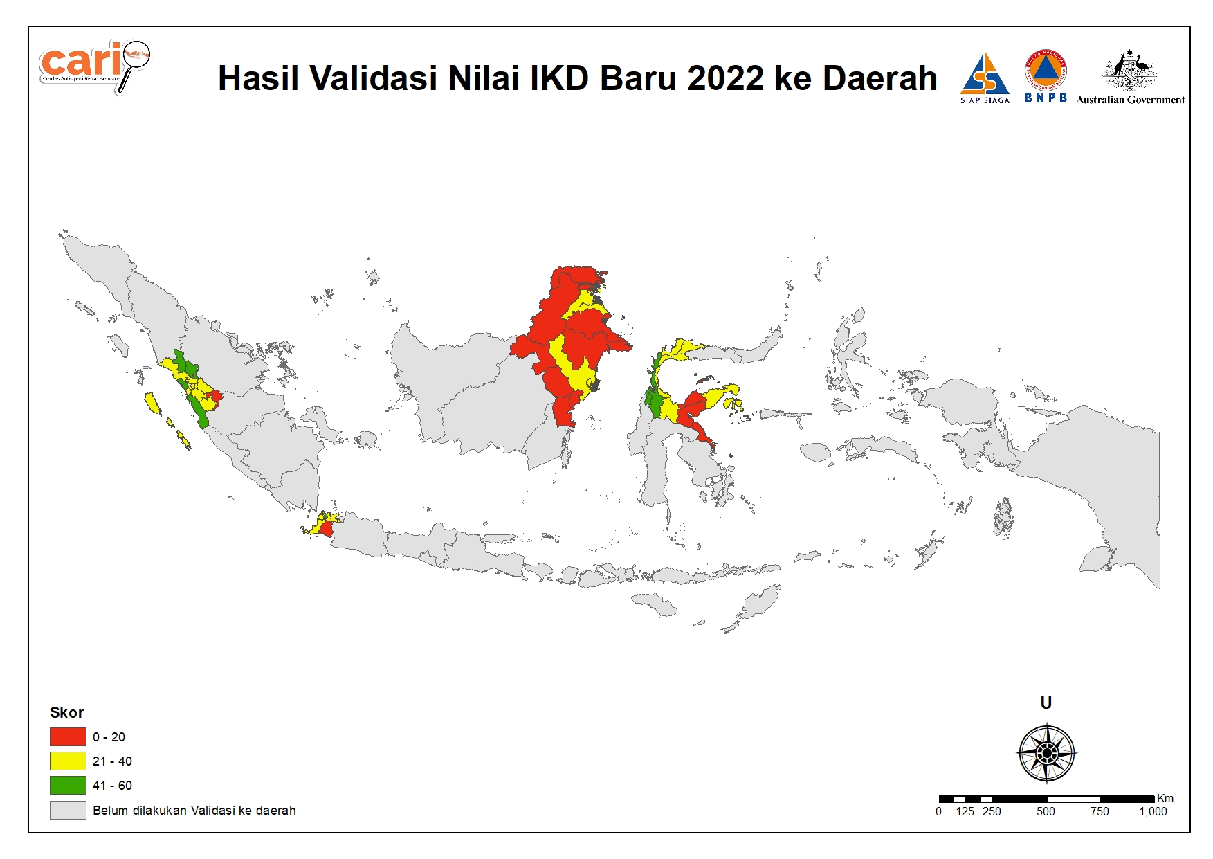
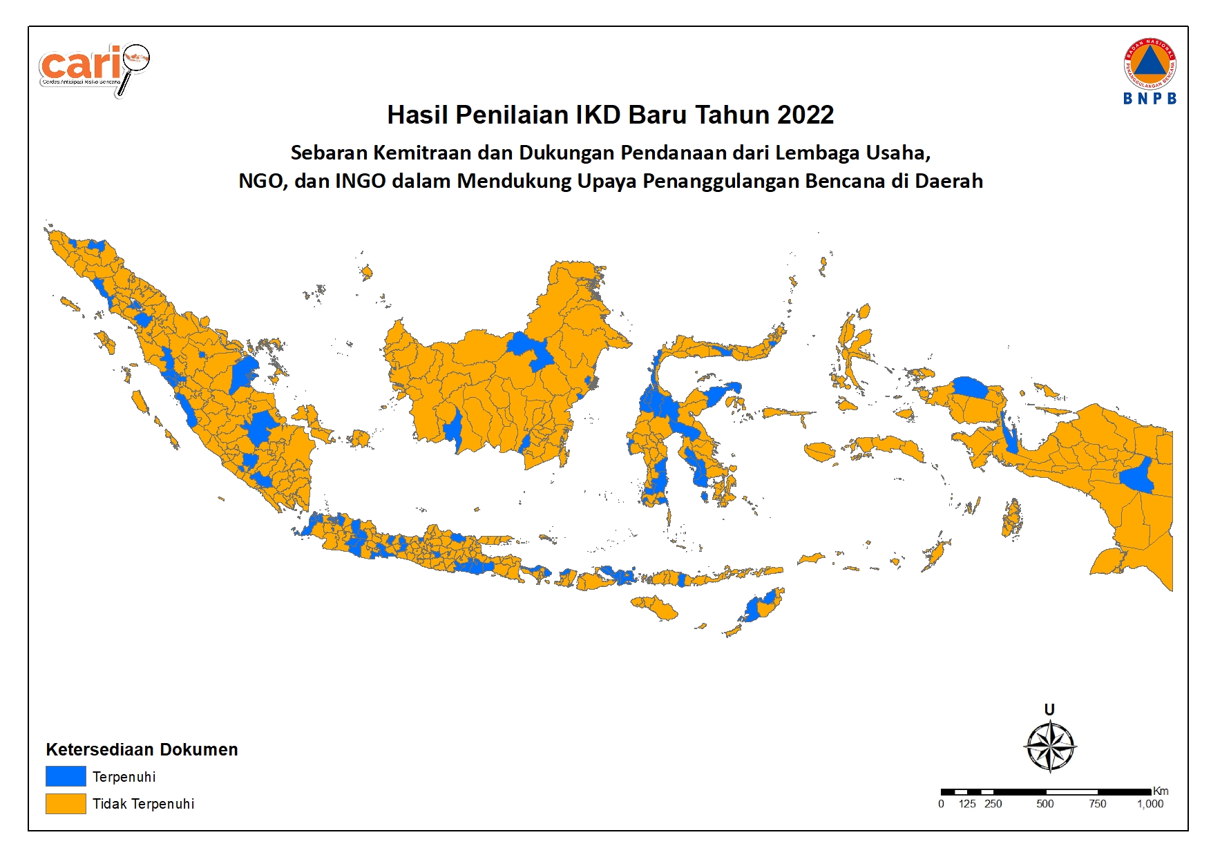
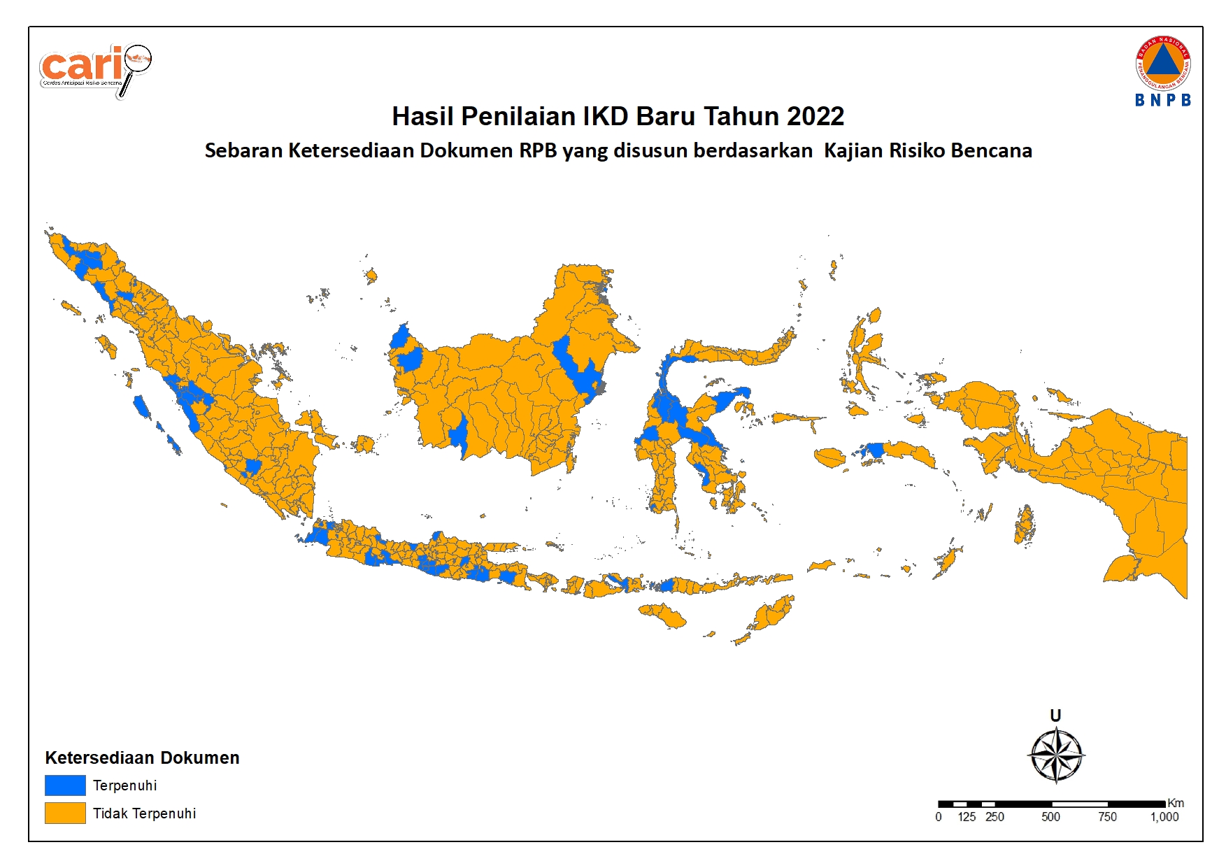
Spatial Data Visualization is a tool or output created with the purpose of simplifying and representing spatial data in a two-dimensional graphical form. Spatial Data Visualization has various applications and can assist users in understanding complex information and data related to the geographic distribution of a particular region or topic. With information presented visually, policymakers can more effectively plan and implement measures to enhance regional resilience and the quality of life for the community.

Risk Assessments
Risk Assessments with Spatial Analysis is a product or service aimed at identifying potential hazards and analyzing the possible impacts of an event or project. The risk assessment process is crucial in various contexts, including enhancing understanding of the surrounding environment and contributing to better decision-making and the mitigation of potential losses.
H3 Spatial Index
H3, an innovative geospatial indexing system, transforms the world into a grid of hexagonal cells, providing an open-source solution licensed under Apache 2. With its hierarchical structure, H3 tackles the data science challenges faced by Uber, enabling the integration of diverse datasets. This powerful indexing system goes beyond the advantages of hexagonal grids, offering features for flow modeling, making it an ideal choice for leveraging Machine Learning in geospatial data analysis.
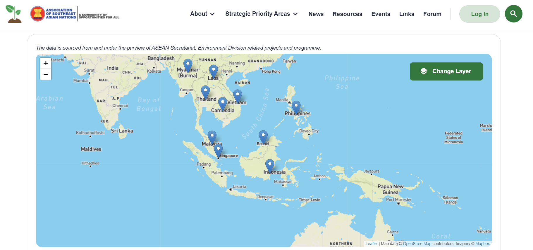
Web GIS
Web GIS is a highly useful solution for various sectors, including government, businesses, research institutions, and many others looking to harness the power of geographic information in presenting geographic data interactively and informatively. Web GIS is invaluable for various purposes, including interactive maps, geographic data visualization, and location-based information communication.
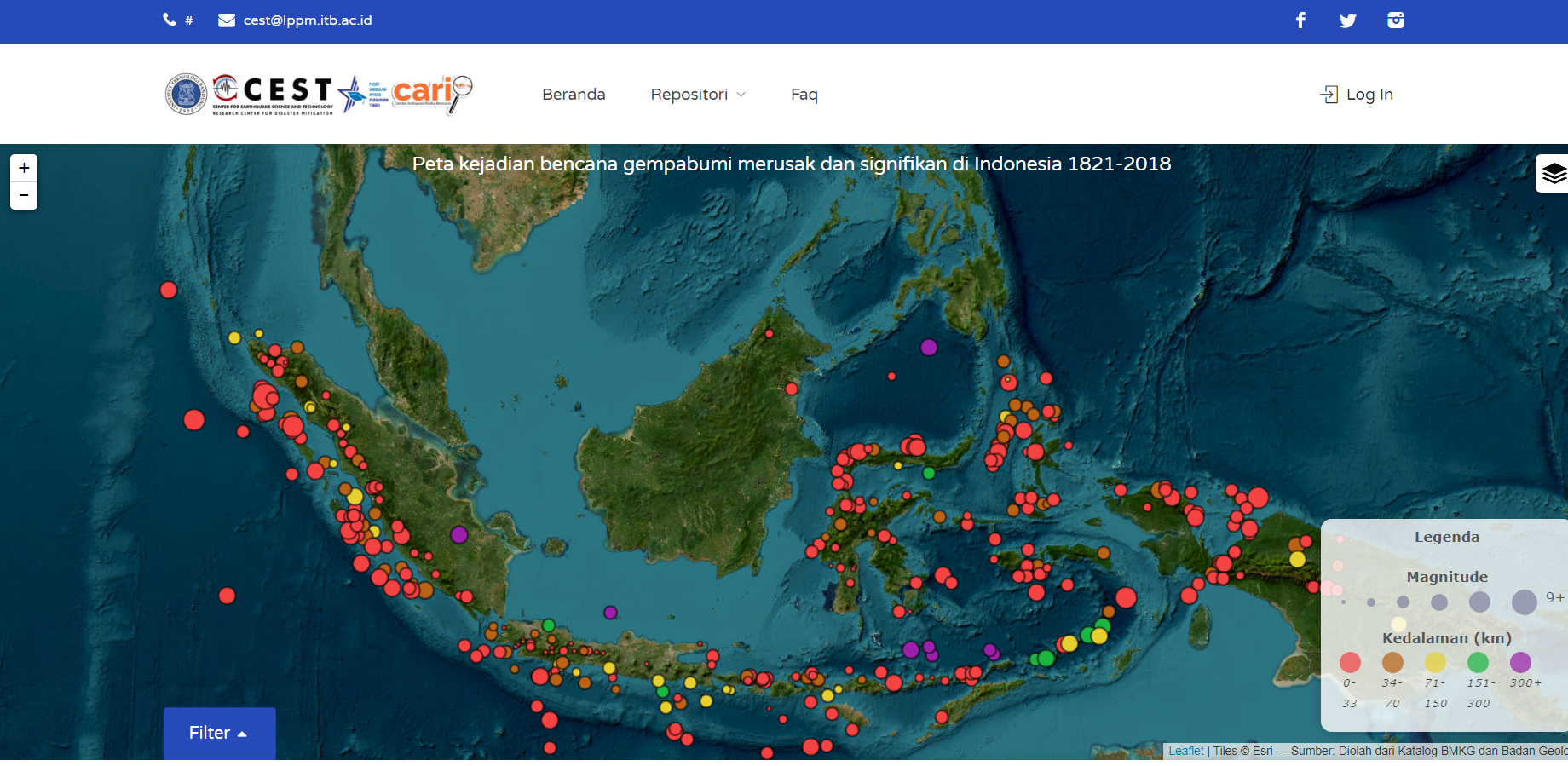
The Map of Damaging Earthquake Disaster Events in Indonesia 1821-2018 is an important source of information for visualizing and understanding earthquake patterns in Indonesia over nearly two centuries.
ASEAN Environment Knowledge Hub (hereafter: The Hub) is developed to become an integrated knowledge management system that supports ASEAN Member States (AMS) in moving towards a more effective environmental data and information management system and serves as a helpful resource to support ASEAN in its policymaking and processes.